
High Wind Warnings Updated to Include Larger Area, Longer Time Period including all of GLOW Region
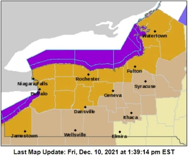
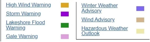
What started out yesterday as a wind event much like that of Monday, has in the last 24 hours turned into a more significant wind warning. The warning includes regular wind speeds of between 35 and 45 mph with winds gusting between 65 and 70 mph.
The advisory started out with a time frame of 1pm to 7 pm Saturday, then was extended to 11 pm Saturday and then went to 1 am Sunday. Now windy and breezy conditions will continue beyond one day.
What did not originally include counties beyond those bordering Lake Erie and Ontario, has now expanded to include all of Western New York and well into Central New York. The announcements pertaining to preliminary cautions have now been leaning more toward those of dangerous conditions, downed limbs and power lines.
At least one Buffalo area television station was advising that all outdoor decorations be brought indoors to prevent damage and loss.
Some counties are advising against driving during much of the event while others are advising high profile vehicles to consider postponing being out on the Interstate 90, particularly along Lake Erie. Several public events were already cancelled for tonight.
Look over the above chart and keep watching for updated reports since forecast conditions have been changing and hopefully will change again but this time in reverse--for the good.
No comments:
Post a Comment
Genuine commenting is warmly welcomed--Advertising is not welcome in the Comment Section and will be removed without further explanation.